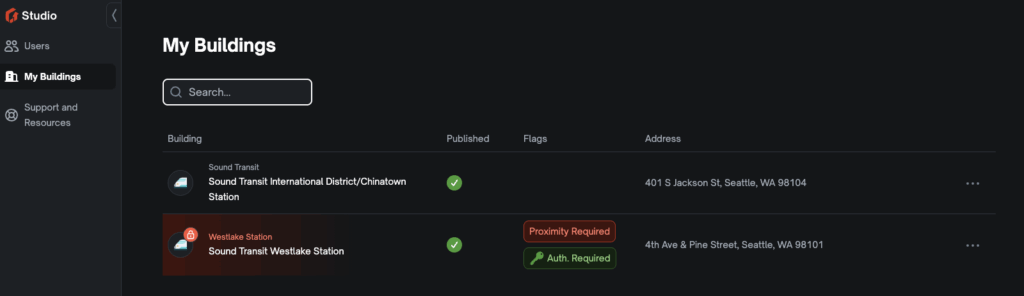
The ‘My Buildings’ page is where you can access all the mapped buildings that belong to your organization.
Search #
You can search for a specific building in your organization using the search bar.
Building Information #
Each building has the following information:
- Icon representing the type of map (Transit, Airport, etc)
- Name of the building
- Whether or not the building is published
- Flags (see Flags section for explanation)
- Address
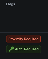
Flags #
Flags can mean a few things:
- Proximity Required means that an app user has to be within a kilometer (or 0.62 miles) of the map.
- Auth Required means that an app user must be an invited user and sign into the app to access this map.
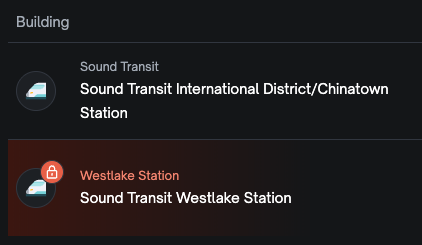
- If you see a Padlock symbol beside the Building Name – that means a mapping team member is working on your map requests. You will not be able to make edits until they have unlocked your map.
Other Options #
If you click the […] (ellipsis) on the far right of the building listing, you will see three additional options.
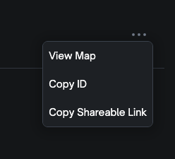
- View Map – which will take you to the map for that building. There, you can make edits to the destinations, see a route preview, and manage translations.
- Copy ID – this copies your unique building ID for when you need to share it with someone.
- Get Shareable Link – this creates a link you can share. If they have the GoodMaps app downloaded this will open the app directly to your unique map so they can start routing or use LookAround!